
A small section of a transmission line—or even the area between one or two towers—where systemic weather conditions (local climate), combined with specific topographical features, cause certain climatic factors to intensify to the point of exceeding the design ice and wind conditions for that region, thereby potentially endangering the operation of the transmission line, is referred to as a “micro-topographic micro-meteorological zone.”
There are tens of thousands of microtopographic and microclimatic zones across the country. While a large body of literature focuses on research specific to a particular route or region, this lacks universal practicality. It is necessary to classify these small areas and conduct targeted research on each category to provide a reference for route design, modifications, and accident analysis in microtopographic and microclimatic zones. Many people classify microtopographic and microclimatic zones based on topography alone, but I believe it is only meaningful to study microtopography and microclimate together. After discussions with experts from the branch office, we conducted a brief analysis of the following three typical topographic-climatic zones.
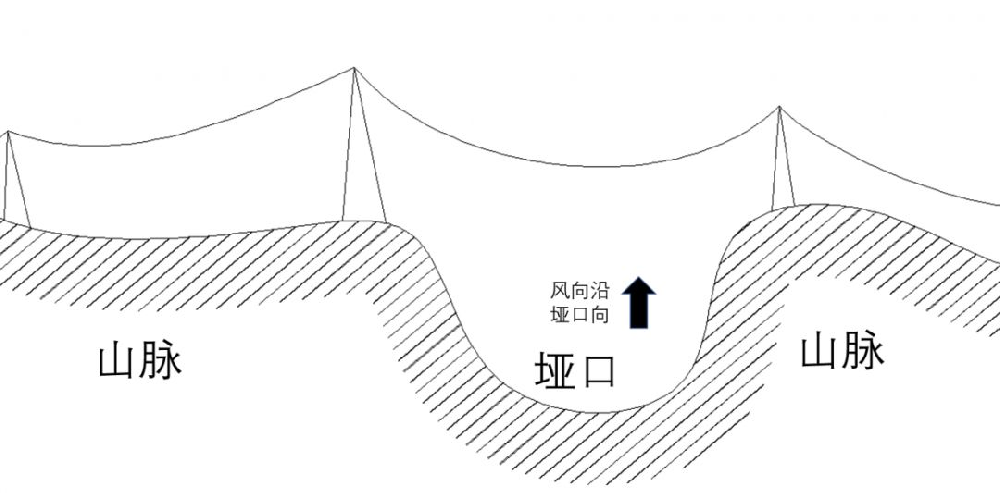
Passes and gorges formed by rolling mountain ranges are areas where air currents converge and accelerate; when a power line is located in or crosses such a pass, wind speeds will increase. When airflow enters a canyon—moving from an open area into a narrow one—the flow field compresses and the airflow converges toward the center, causing wind speeds to increase significantly. When airflow passes over a transmission line that crosses a mountain pass, the conductors experience a certain degree of displacement and deflection toward the towers, reducing the discharge gap. On the other hand, under the influence of strong winds, heavy rain forms directional, intermittent water streaks along the wind direction. When these water streaks align with the direction of the discharge path, the power-frequency flashover voltage in the air gap between the conductor and the tower is further reduced, increasing the probability of wind-induced conductor deflection on the line.
Relevant studies indicate that the wind conditions in this area have the following characteristics:
1. Wind speeds along the central axis of the valley exceed local flatland wind speeds by more than 30%, and wind speeds at the tops of hills exceed local flatland wind speeds by more than 40%, whereas the standard specifies that this figure must not exceed 10%.
2. The increase in wind speed at the pass increases as the slopes of the surrounding hills become steeper, and decreases as the width of the valley mouth increases.
3. Downwind wind speeds in a valley are higher than those on the upwind side.
When wind speeds exceed the threshold in mountain pass areas and are accompanied by low temperatures (below 0°C) and high humidity (above 85%), the wind flowing through the pass continuously carries a large number of supercooled water droplets toward the power transmission lines spanning the terrain. These droplets collide with the conductors, are captured by them, and form ice accumulation. Under the combined effects of strong winds and ice accumulation, accidents such as tower yielding and conductor breakage are likely to occur.
The impact of microtopography and microclimate on transmission lines is often the result of specific terrain conditions combined with particular weather patterns, leading to localized strong winds, high humidity, and low temperatures, which ultimately cause ice accumulation on the lines or wind speeds that exceed design values. In practice, these microtopographic and microclimatic conditions rarely occur in isolation; therefore, it is necessary to install online transmission line microclimate monitoring systems or conduct ice accumulation inspections, as these factors often coexist in complex combinations and interact with one another.